
Montaña de Tindaya: Fuerteventura's Sacred Mountain

Montaña de Tindaya is a red-rock hill in the municipality of La Oliva, on the north-west side of Fuerteventura, and you visit it by looking at it rather than walking up it. Hiking on the mountain is not allowed because the pre-colonial islanders treated it as a sacred place, so the honest plan is a short drive-and-viewpoint stop with the archaeology explained before you arrive.
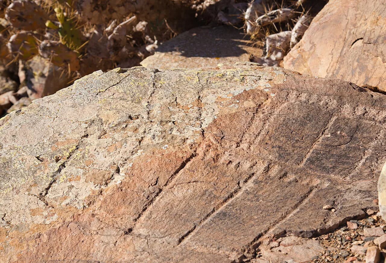
The reason the hill matters is the rock art: foot-shaped petroglyphs and structures cut into the stone, which is what earns it protection. Spain's official tourism site lists the petroglyphs on Tindaya Mountain among the obligatory visits in La Oliva, and describes the town as one of the island's richest archaeological areas.
What Montaña de Tindaya Is
Montaña de Tindaya is a single named hill, not a park or a visitor centre, and it sits in the La Oliva municipality that covers much of Fuerteventura's north. The hill's importance is cultural and archaeological rather than scenic alone: the carved footprints mark it out as a sacred site for the island's pre-colonial inhabitants, known as the Majoreros.
Treat it as a landmark you read about and photograph from outside, in the same way you would approach a protected archaeological site anywhere in Spain. The mountain is the point of the visit; the village of Tindaya at its foot is simply where you pass through on the approach road.
Where It Sits and What You See From the Approach
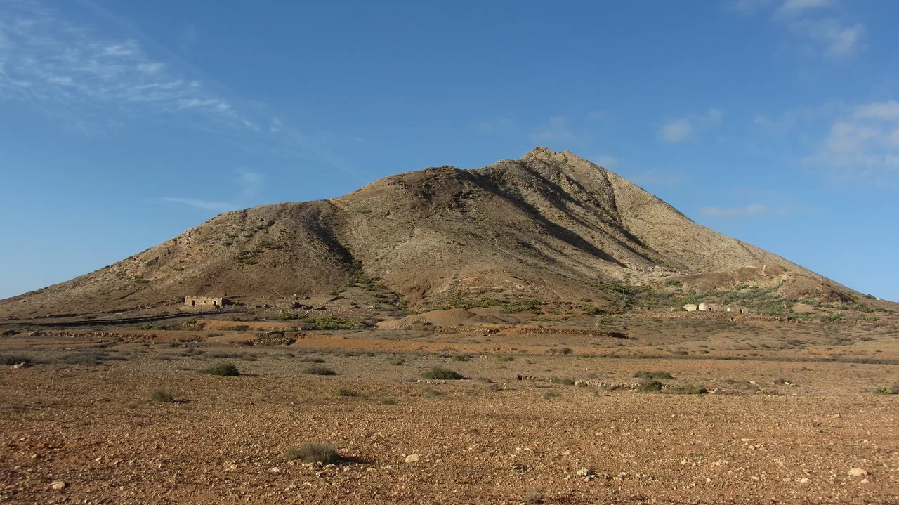
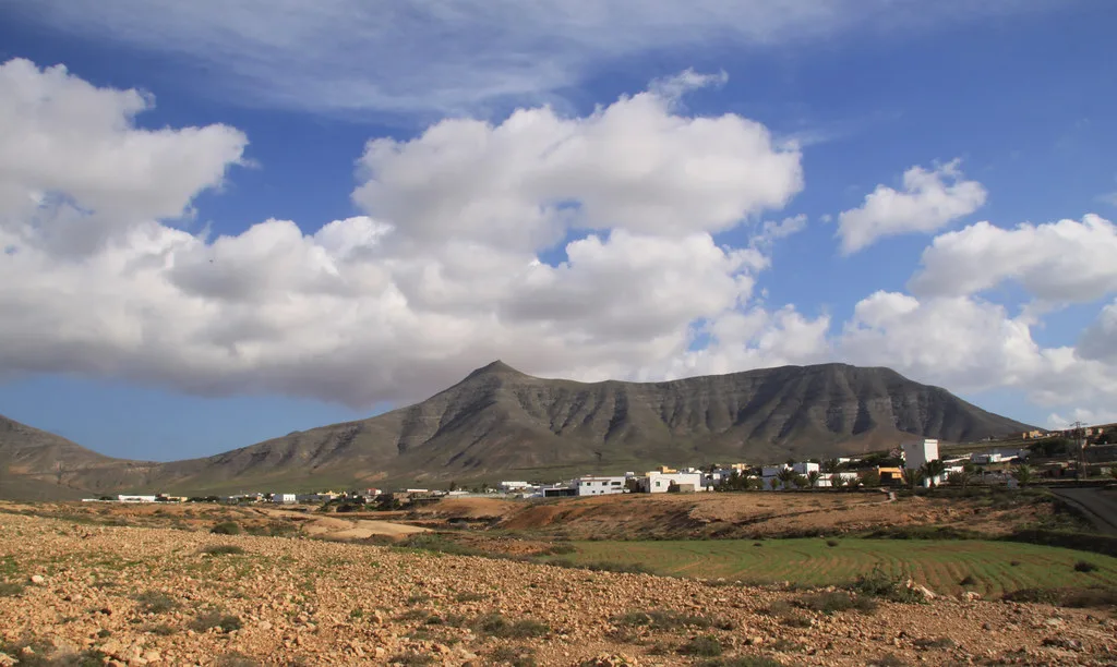
The hill stands close to the village of Tindaya, inland from the north coast and roughly between La Oliva and the coast road that runs up to El Cotillo. Driving the FV-1 corridor from Puerto del Rosario or Corralejo brings you into open, dry country where the cone-shaped hill is visible well before you reach it.
From the approach road you get the full silhouette against the flat surrounding plain, which is the view most visitors come for. Nearby Villaverde is known for its windmills standing between arid, winding roads, and they make a natural second stop on the same loop.
The Carved Footprints
The petroglyphs are cut in foot-like shapes and structures on the mountain, and they are the reason the site is protected rather than simply quarried or built over. Spain's official tourism site groups Tindaya with the wider archaeological wealth of La Oliva, which it describes as showing ample evidence of aboriginal presence in the area.
You will not be walking among the carvings, so the useful preparation is reading about the foot motifs before you go and then viewing the hill from a distance. Interpretation boards, if any, are not something to count on: bring your own context rather than expecting a museum-style explanation on site.
Access and the Hiking Question
You cannot hike up Montaña de Tindaya: walking on the mountain is not permitted because of its status as a sacred place to the pre-colonial islanders. That rules out a summit walk, a crater circuit or a trail to the top, so do not build a day around climbing it.
Plan instead to see it from public roads and viewpoints around the village, where the shape and colour of the hill read clearly. If you want a walk in the same half-day, put your boots on a permitted route nearby rather than on Tindaya itself, and our Fuerteventura Neighborhoods guide helps you place the north-coast villages around this stop. It pairs well with our guide to things to do in Fuerteventura if you are deciding which permitted walks and beaches fill the rest of the day.
How to Get There and How Long to Allow
Fuerteventura's buses do not reach every corner comfortably, and the island's north is easiest with your own wheels, which also lets you link Tindaya with the coast in one run. Allow roughly half an hour to an hour at the village and its edges: enough time to take in the hill from a couple of angles and read up on the carvings.
A car also makes the pairing obvious: Tindaya in the morning, then the short hop south-east to Lajares for Calderón Hondo. Check road access and any local restrictions on the day, as arrangements around protected land can change.
Nearby: Calderón Hondo and the Villaverde Windmills
Calderón Hondo near Lajares is the walk that fills the gap Tindaya leaves, since it is a permitted hike to a well-preserved volcanic crater with views over the Bayuyo chain of mountains. From the town of Lajares the path runs about 2.8 km and climbs 278 metres of altitude, which is a modest outing for most fit walkers.
The Villaverde windmills sit on the same inland loop and give you a second short stop without doubling back. If you are building a wider north-island day, the Corralejo dunes and the boats to Isla de Lobos are both within easy reach of this corridor, and you can plan the rest of that circuit with these things to do in Fuerteventura.
Further afield, Betancuria in the Macizo de Betancuria makes a contrast for another day, with the island's old administrative centre and its mountainous setting inland from the west coast. Save it for a separate outing rather than bolting it onto a Tindaya stop.
Who It Suits and Who It Doesn't
Tindaya suits travellers who like archaeology and landscape and are happy with a 30-minute roadside stop that rewards a bit of prior reading. It does not suit anyone expecting a summit hike, a visitor centre or a ticketed attraction with facilities.
Families with small children and travellers without a car should weigh it carefully, because the payoff is a view rather than an activity. If your group needs hands-on things to do, put the time into beaches and the water instead.
Practical Points: Sun, Wind and Facilities
The north of Fuerteventura is dry, bright and breezy, so carry water, a hat and a windproof layer even for a short stop. Do not rely on cafés or toilets at the mountain itself; the village is small and the stop is essentially outdoors.
Wind is the defining feature of the island's weather, strong enough that it shapes how people plan beach days, so check the forecast before you commit to an exposed viewpoint. The Canary Islands run an hour behind mainland Spain, the same as the UK, which makes timing calls easier for British visitors.
Plan Your Visit
Montaña de Tindaya works best as a short, informed stop on a north-island loop: see the hill from the approach road, understand the foot-shaped carvings, then spend your walking time on Calderón Hondo or the dunes. For the beaches and villages that fill the rest of the day, see these things to do in Fuerteventura. Confirm any current access restrictions and local advice before you drive out, since the mountain's protected status governs what you can do there.
Frequently Asked Questions
Can you climb Montaña de Tindaya?
No. Walking on the mountain is not allowed because the pre-colonial islanders treated it as a sacred place. Plan to view it from the roads and viewpoints around the village of Tindaya instead, and put any actual hike into a permitted route nearby such as Calderón Hondo near Lajares.
Why is Tindaya Mountain sacred?
The hill was a sacred site for Fuerteventura's pre-colonial inhabitants, the Majoreros, and it carries foot-shaped petroglyphs and structures cut into the rock. That rock art and its cultural value are what make the site protected today, which is also why access on foot is restricted.
What are the footprints on Tindaya Mountain?
They are petroglyphs carved in foot-like shapes and structures on the mountain, part of the archaeological heritage of the La Oliva municipality. Spain's official tourism site lists the Tindaya petroglyphs among the key visits in the area and describes La Oliva as one of Fuerteventura's richest archaeological zones.
Where is Montaña de Tindaya in Fuerteventura?
It stands by the village of Tindaya in the municipality of La Oliva, on the north-west side of the island, inland from the north coast and roughly between La Oliva and the road up to El Cotillo. It is easiest to reach by car along the FV-1 corridor from Puerto del Rosario or Corralejo.
Is Tindaya worth visiting?
Yes if you care about archaeology and landscape and accept a short roadside stop rather than an activity. No if you want a summit walk or a ticketed attraction with facilities. Pair it with Calderón Hondo and the Villaverde windmills to make a half-day of the northern interior.
How much time should I allow for Tindaya Mountain?
Allow roughly half an hour to an hour at the village and its edges to see the hill from a couple of angles. The visit is a viewpoint stop, so most of your half-day will go on the drive and on a permitted walk such as Calderón Hondo.
Do I need a car to see Montaña de Tindaya?
A car is the practical way to see it, because the northern interior is not well covered by bus routes and you will want to combine Tindaya with other stops. Check road access and any local restrictions on the day, as rules around protected land can change.